Willow & cottonwood
Where it shows upShoreline and low drainage areas.
Project effectFast-growing trees can have broad, moisture-seeking roots and weaker wood. Removal plans should consider bank protection and overhead hazards.
 DentonLand Clearing
Lake Dallas, Texas
Lake Dallas combines compact urban lots with shoreline-influenced slopes, drainage, and mature trees that call for careful access and erosion planning. Every project is approached with careful execution and close attention to the finished result.
Local ground, local decisions
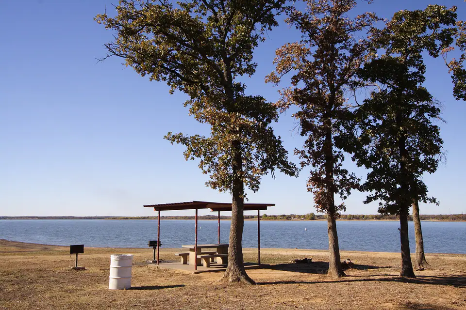
Lake Dallas is a compact community between the I-35E corridor and Lewisville Lake. Its parks and trails include wooded shoreline areas and direct lake access.
Projects range from residential access and storm cleanup to selective lot preparation where neighboring structures and mature canopy are close.
Because the city lies along Lewisville Lake, even properties away from the immediate shoreline drain through a connected system of streets, creeks, and parks. Clearing should keep runoff, neighboring grades, and limited staging space in view.
Trees & vegetation
Tree species can hint at drainage, soil, historic land use, and maintenance needs. Identification, health, and exact site conditions should still be confirmed on the property.
Where it shows upShoreline and low drainage areas.
Project effectFast-growing trees can have broad, moisture-seeking roots and weaker wood. Removal plans should consider bank protection and overhead hazards.
Where it shows upAlluvial low ground and older lots.
Project effectGood canopy may be worth preserving, but roots and canopy spread need space outside future foundations and utilities.
Where it shows upHigher, drier ground.
Project effectProtect stable mature trees from grade cuts, fill, and root compaction during access work.
Where it shows upEdges and unmanaged screens.
Project effectSelective thinning improves access and airflow while retaining privacy where desired.
Lower and shoreline-adjacent ground may stay wet longer, while exposed slopes can erode once roots and cover are removed. Stabilization and debris containment are part of a complete scope.
Tree-to-finish diagram
A tree can stay, be processed at the surface, or be removed with its root system. The future use makes the decision.
Important: A visual tree check is not an arborist risk assessment. Valuable, protected, or questionable trees may need review by a qualified arborist.
Planning in Lake Dallas
Removing roots, changing grade, or concentrating runoff can move problems downhill. Clearing limits and stabilization should work together.
Compact lots may require smaller loads, offsite disposal, or phased processing because there is little room for piles and equipment turning.
Floodplain, drainage, Corps, city, or subdivision requirements may apply depending on the parcel and type of disturbance.
A better project sequence
Confirm boundaries, easements, utilities, drainage, and the future layout.
Identify clearing limits, keeper trees, access, staging, and protected areas.
Use mulching, cutting, grubbing, haul-off, or a combination by zone.
Backfill, rough grade, stabilize, and leave a defined handoff for the next trade.
Services in Lake Dallas
Start with the closest match. Related work can be coordinated into one clear, quality-focused site plan.
Clear, grub, and prepare property for construction, agriculture, access, or sale.
Service details →Process brush, cedar, saplings, and unwanted understory into an onsite mulch layer.
Service details →Remove selected trees, root balls, storm debris, and unwanted material from the work area.
Service details →Shape rough ground and create workable routes for vehicles, equipment, drainage, and construction.
Service details →Open maintained corridors for fencing, utilities, equipment, recreation, and inspection.
Service details →Reclaim grazing ground, maintain acreage, and manage regrowth over the long term.
Service details →Mulch, wood chips, topsoil, fill, and driveway aggregate delivered for property projects.
Service details →Common local projects
Before work begins
Quotes consider vegetation type and density, tree size, terrain, access, stumps, debris handling, acreage, and the finish expected after clearing. Photos help, but an onsite review is the reliable way to confirm scope.
The owner provides reliable boundaries, easements, and work limits. Public utilities must be located before digging, and private lines such as irrigation, septic, electric, or propane may need separate identification.
Tree-preservation, floodplain, burn, development, and grading requirements vary by property and project. Owners should confirm current rules with Lake Dallas, Denton or Tarrant County as applicable, and any other authority before work.
Ecology and soil guidance is informed by the Texas Parks & Wildlife Cross Timbers overview, Ray Roberts Lake natural-area guide, and USDA soil survey resources. These regional references do not replace parcel-specific surveys, engineering, arborist advice, or current local requirements.
Top-quality work. Clear expectations.
We carefully plan and execute clearing, mulching, grading, access, and material work around the property, the agreed scope, and the result you expect.